GARMIN LakeVu G3 Ultra Chart
$283.99
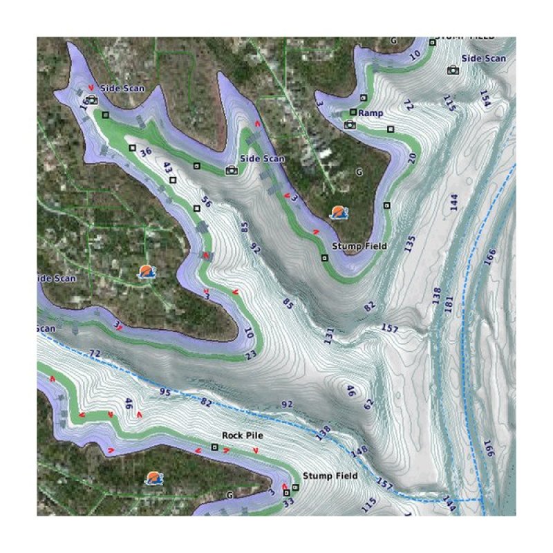
GARMIN LakeVu G3 Ultra Chart
The Premier Freshwater Fishing Map
- Industry-leading coverage, clarity and detail with updated inland maps that feature integrated Garmin and Navionics® content
- Coverage for more than 13,500 total lakes, of which more than 4,800 have up to 1’ contours
- Auto Guidance¹ technology quickly calculates a suggested route by using your desired depth and overhead clearance
- High-resolution relief shading makes it easier to see contours and find fish holding structure
- Depth Range Shading for up to 10 depth ranges enables you to view your target depth at a glance
- Experience unparalleled coverage and brilliant detail when you’re on the water. Canada LakeVü g3 Ultra inland maps provide industry-leading coverage, clarity and detail with integrated Garmin and Navionics content.
Features
Auto Guidance
- Whether you are fishing or cruising, select a spot, and get a route showing you the general path and nearby obstructions at a safe depth¹.
High Resolution Relief Shading - The high-resolution relief shading feature adds visual depth to the 2-D map, making it easier to interpret contours and find fish holding structure.
Depth Range Shading - This feature displays high-resolution Depth Range Shading for up to 10 depth ranges so you can view your designated target depth.
Shallow Water Shading - To give a clear picture of shallow waters to avoid, this feature allows for shading at a user-defined depth.
Fish-eye View - This underwater perspective shows 3-D representation of lake bottom and contours as seen from below the waterline. Interface with sonar data for a customized view.
CATEGORIES
- Barbeques and Accessories
- Cleaning & Boat Care Products
- Fenders & Mooring Accessories
- Kneeboards
- Marine Electronics & Trolling Motors
- Portable Outboards Mercury
- Portable Outboards Yamaha
- PWC Accessories
- Stand-Up Paddleboards, Paddles and Accessories
- Surfboards
- Towables
- Towers and Accessories
- Trailer Accessories
- Wakeboards, Boots and Bindings
- Wake Surf Boards
- Waterskis
- Water Sport Ropes and Handles
- Water sport Vests and PFDs